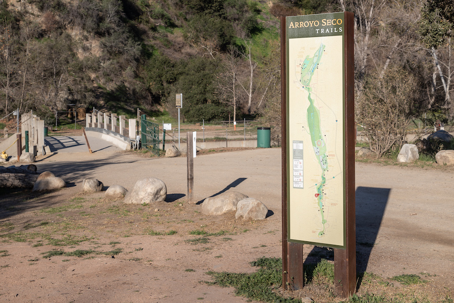
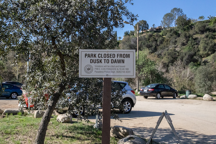
Dirt crackles beneath my tires as I roll through the dusty parking lot at the head of the Lower Arroyo Park Area. The car stops. I grab my camera, leash Milo, exit the vehicle and approach a tall sign at the trailhead where a diagram maps out walking paths in the surrounding area. The trail ranges from the Jet Propulsion Laboratory campus in the north to the border of South Pasadena down below. We won’t tackle all of this today, just a portion. But a portion is enough.
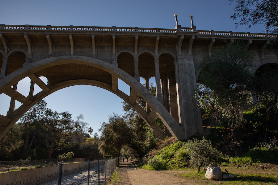
Milo and I head north from sign, curving away then back toward the east side of the stream as the Colorado Street Bridge comes into full view. Los Angeles isn’t widely known as a bridge town, but as bridges go, this one has some charm, if not a touch of gloom.
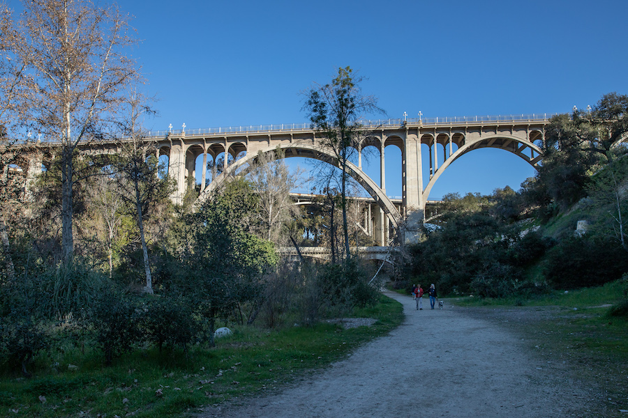
Beaux Arts arches rise and dip, backed by a canvas of blue sky already crisp in anticipation of afternoon warmth. The span before me is more than a century old, but it’s the newest feature that catches my eye, a 10-foot-high chain link fence which guards the railing from would be climbers… and jumpers. Suicide Bridge is what some locals call it. The reputation is, sadly, well earned.
According to the L.A. Times, over a hundred people have taken their own lives by leaping off the bridge since 1915. In 2017 the city installed a fence, and in the years since I haven’t heard or read of any deaths I guess the project is doing its job. Still, staring at that chainlink and pondering its necessity, I can’t help but wonder what pushes a person to make that 150-foot plunge.
As we near the underpass, the path presents an option to continue north to the Rose Bowl, but this is not the way. At least not for me, and at least not today. Instead, we scoot south, take a crossing to the other side of the Arroyo to begin the process of what will be a 3-mile loop.
Gaspar de Portolà coined the name Arroyo Seco , which literally translates as “dry creek” in Spanish. During his expedition of 1770, Portolà marveled at the distinctive lack of water in the surrounding canyon. Then again, the Spaniard probably never saw this land when the rain gods were in beast mode.
Like other natural waterways in the basin, the potential for flooding looms, drought or no drought. In digging through the history of the Arroyo Seco, I came across tales of a biblical flood hit the western United States in the winter of 1861-62.
“The Cattle on a Thousand Hills” drowned an estimated 200,000 cattle, killed thousands of people, and damaged or destroyed a full one-third of the state’s property. It rained for 40 plus days in a row. Can you imagine that?
Californians tend to consider climate impact in terms of running out of water… think Owens Valley or the Salton Sea… but we hardly ever consider the flip side, even though the risk is woven into our history, and the chances of another mega flood are only increasing.
Here at the Arroyo, past floods ensured local officials played their share of defense. There was Los Angeles County’s Flood Control’s first dam project, Devil’s Gate Dam, built in 1920 as part of the effort to control flooding in downstream. There was the channelization of the Arroyo in the 1930s. And yet, somewhere in the back of my mind the chiding voice of Mike Davis echoes. Do we really think we can fully master nature, or is all just a lulling us into a false sense of security? A table cloth draped over a ticking time bomb.
So much for that calming early morning walk.
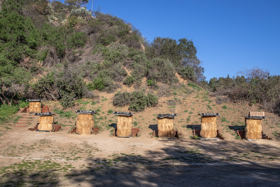
I continue south past the bridge near the trailhead, and catch sight of a sign that begs consideration. “Caution Archery Range,” the words say. My eyes investigate, then my feet follow.
The offshoot opens up to a wide strip of dirt, dotted by patches of scruffy grass. Little brick alcoves paved into the hillside hug a row of hay bale target backers. But here there are no would-be Robin Hoods or Katniss Everdeens. Just me and the dog, and not an arrow or quiver in sight.
The Pasadena Roving Archers maintain the grounds at the range, and they hold classes on Saturday mornings for first time archers. Years ago, when I first started writing about things to do in L.A., I remember that the weekly instruction was free. These days, PSA charges $5 for a spot, and from my cursory attempt to book a slot, it’s still fairly impossible to nab a reservation. Money or no money, demand is high.
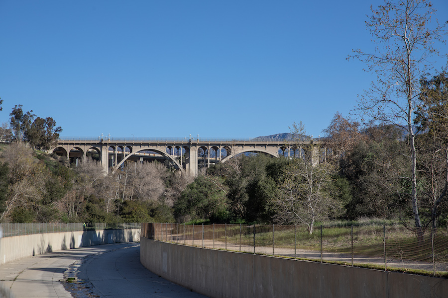
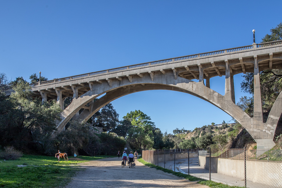
Milo pulls me away from the range and back along the stream’s edge. He is the captain now. The pace quickens as we skip past a rock labyrinth and a few ragged signs that look like they were part of some community art project, now just hanging on dear life. About a half mile south we pass under the John K. Van de Kamp Bridge (formerly La Loma Bridge), which mirrors the neoclassical style of its brother bridge to the north.
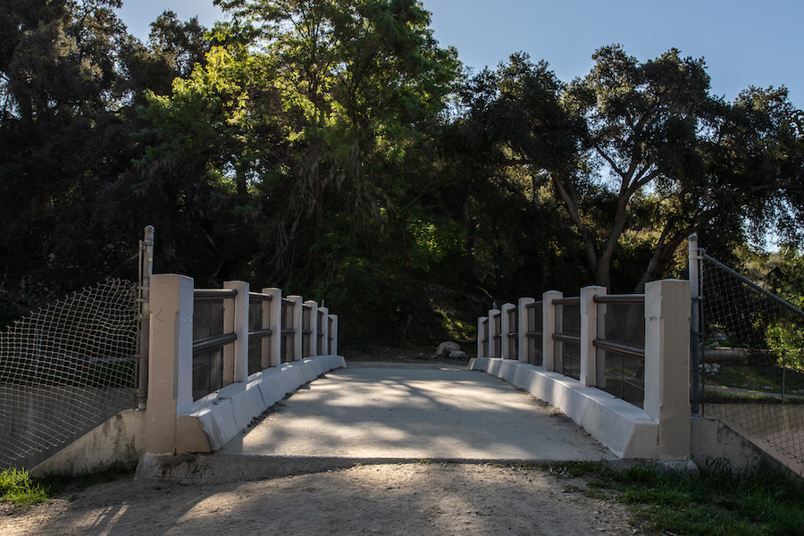
As the morning drags on and the sun climbs, sweat beads on my hat-covered forehead. Shade is what I crave, and I’m in luck. Just past the the overpass for San Rafael Ave is a foot bridge we cross to get to east side of the Arroyo, where trees provide momentary cover. A route to the south offers access to the nearby San Pascual Stables and Arroyo Park. But for us, it’s time to complete the loop.
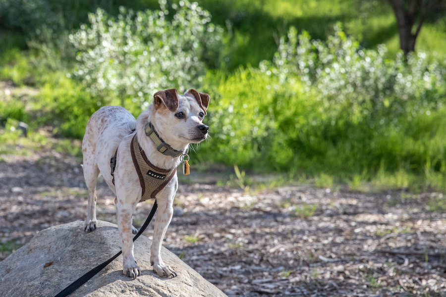
The thought of the stables has barely trotted through my mind when we spot a horse being led along the trail under San Rafael. Other more polite dogs walk by and think nothing of it, but not Milo. Something about equines sends him into a blind rage. I think it’s a height thing. Milo is short, and horses are tall. I guess I’d be mad too.
As in previous walks, I do try to find a moment here or there to take a photo of the dog. You know, for the ‘gram. A little further north, past a habitat restoration sign, the trail dips away from the stream and into a clearing where the defused light freckles the tops of the shrubs, and a rock provides a fine perch for a little dog. Also, there are no horses around to flip the beasts’ insanity switch. He poses, I shoot, and then we move on.
The final leg of the walk takes us past another unexpected find, a casting pond just south of the trailhead that is operated by the Pasadena Casting Club. The pond is one of only three in the state, and unlike the archery range to the west, it seems to be getting good use upon the day of my visit.
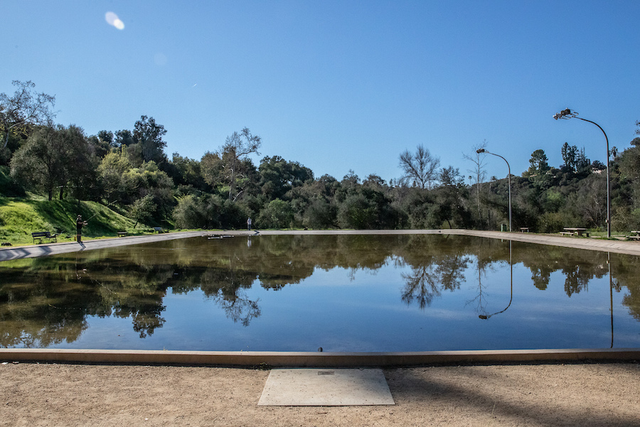
Milo and I take position at the north edge of the water and watch for a few minutes as poles fling back and forth, swung with smooth, well-practiced grace. I wonder if the fishermen actually catch anything or they just do it because the repetition puts them into a zen-like trance. Like their form of a mantra. I think to ask but decide it’s better not to approach and risk interrupting the calm.
We return to the parking lot and I check my water bottle for a sip but find it empty. The sweatband of my ball cap is soaked. It’s the right time to finish.
On this day, the footsteps were light, but the thoughts hung a bit heavy. Contemplation of floods and drought. Reflections on what pushes a human to volunteer their own end. A dog driven mad by a horse. Life isn’t all clear blue skies and sunshine, I guess, even when that’s all you can see.
Maybe I should try it again on a cloudier day.
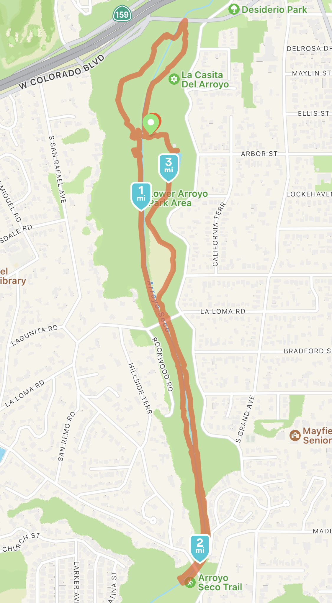
Starting Point: 415 S Arroyo Blvd, Pasadena, CA 91105
End Point: Same
Distance: 3.18 miles
Miles Until Goal: 975.65
Previous: Walking Around The Silver Lake Reservoir and Up the Mattachine Steps | L.A. On Foot #8
Next: Walking 4.5 miles at Kenneth Hahn Park | L.A. on Foot #10