Ever wonder what L.A.’s public transit system looks like operating in real time?
Well, now you can check it out with something call TRAVIC.
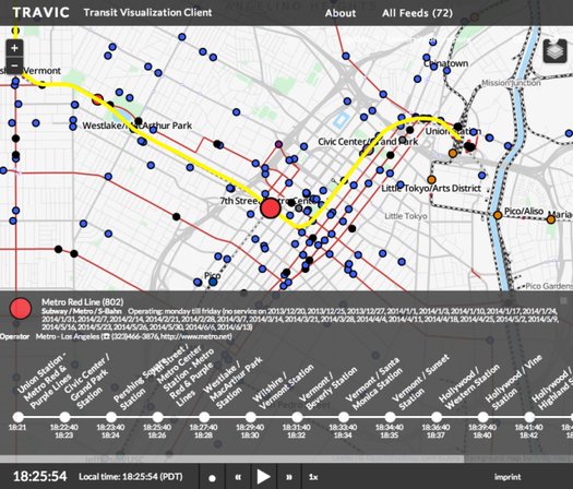
TRAVIC was developed by University of Freiburg grad student Patrick Brosi in conjunction with geoOps and stands for Transit Visualization Client.
The client harvests public data feeds supplied by transit operators like Los Angeles County’s Metro to visualize the location, moment-by-moment, of all the buses and trains in a given system.
All vehicles appear as colored dots on a map. Merely click on a dot, and the software will highlight the vehicle route on the map and list scheduled arrival/departure times.
Of course, the beauty to all of this is that you can visualize all the data at once, so you can watch the ecosystem of buses and trains dance around the map like notes in a symphony when you speed up the display (up to 60x).
In any case, just something neat you might want to play around with to better understand how L.A.’s public transit operates in real time. Enjoy!
[H/T: Gizmodo]
Brian is the co-founder of We Like L.A. and a lifelong fan of puns, the Lakers, and late night tacos. Follow him on Twitter @bchampLA